Jenna Bernabe

GIS Manager

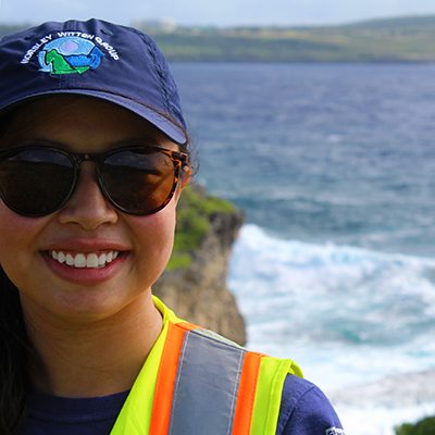
We are pleased to announce that Jenna Bernabe has joined HW as our Geographic Information Systems (GIS) Manager. Jenna earned her B.S. in Imaging and Photographic Technology from the Rochester Institute of Technology and her M.A. in Geography with a concentration on GIS and Remote Sensing from San Jose State University. A Pittsburgh native, she grew up in Northern Virginia. Her internship at the National Geospatial-Intelligence Agency piqued her interest in satellite imagery analysis and motivated her to apply to graduate school where her passion for geography and technology came together. Her master’s thesis was a case study of urban heat island detection using Landsat data. Jenna has over ten years’ experience as a GIS professional and program manager with a transportation industry data services provider located in MA.

When Jenna is not working, she enjoys all that New England has to offer, exploring the outdoors while hiking, skiing, and spending time with her family and young daughter. Jenna likes to run and has finished a marathon in Newport, RI! She also enjoys getting out to local ponds and visiting Cape Cod to kayak with family and friends.

 

Saipan, CNMI

watershed assessments


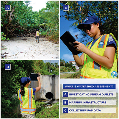
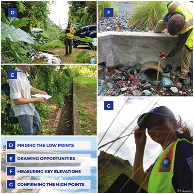
Several years ago, several staff members had the opportunity to travel to Saipan in the Commonwealth of the Northern Mariana Islands (CNMI). The team mapped drainage infrastructure, assessed sources of pollution, and identified key opportunities for restoration within the Achugao, Garapan, and Lao Lao Bay Watersheds. 

The group inventoried age-old infrastructure from WWII, observed active construction today, and saw evidence of our future demand on the land.  While abroad, we talked with residents who told stories from decade ago, collaborated with consultants who shared our same concerns, and met with federal agencies to ensure our decision-making process fit the priorities of the people and the place.

Project Summary:

All three watersheds are impaired, exceeding one or more CNMI water quality standards. We assessed each watershed and identified solutions for land-based sources of pollution.   Sponsored by NOAA and the CNMI Bureau of Environmental and Coastal Quality, we worked closely with Koa Consulting LLC, Sea Change Consulting, and The Nature Conservancy to engage local organizations. We collected field data and mapped drainage infrastructure linking flow-patterns with key opportunities to improve water quality.  Our field teams and workshop facilitators gathered hundreds of data points; produced dozens of restoration concepts; and identified watershed management priorities, challenges, and visions.

Next steps will include  drafting watershed management plans to integrate different stakeholder’s priorities (e.g., on-going capital improvements, restoration efforts, road upgrades) and to balance economic growth with environmental integrity.  As a result of this work, we hope federal and local agencies can implement these watershed solutions to one-day meet the CNMI water quality standards.

HW Project Team:

Josephine Ibanez, Environmental Scientist
Eliza Hoffman, Staff Engineer
Brian Kuchar, P.E., RLA, Principal Landscape Architect
Anne Kitchell, Senior Watershed Planner

Project Partners:

The Nature Conservancy-Micronesia
-Berna Gorong 
Sea Change Consulting
-Meghan Gombos
KOA Consulting LLC
-Becky Skeele & Rob Jordan
Bureau of Environmental and Coastal Quality
-James Benavente

NOAA Coral Reef Conservation Program
-Robbie Greene